


By: Kaja Antic, Staff Writer
Much of what is now called British Columbia exists on the unceded Coast Salish Territories of the Skwxwú7mesh (Squamish), xʷməθkʷəy̓əm (Musqueam), and səlilwətaɬ (Tsleil-Waututh) Nations. As we observe and celebrate Indigenous History Month in the Lower Mainland, it is important to recognize and use the traditional names of the land we live on, whether they are currently used, or more commonly known by colonial names.
Sch’ich’iyúy (Twin Sisters or Two Sisters)

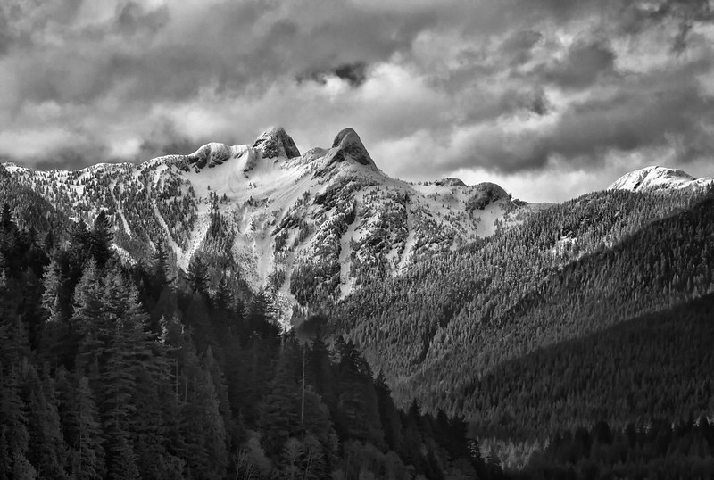
Located on the North Shore mountains at the entrance of səl̓ilw̓ət (the Burrard Inlet), these two peaks were first known in the colonial realm as “The Lions” — which led to the naming of Lions Gate Bridge, and the BC Lions football team. In Sḵwx̱wú7mesh (Squamish) legend told by a late Chief Su-á-pu-luck (Joe Capilano), the peaks were made by the Creator to commemorate peace between the Haida and Sḵwx̱wú7mesh people, after Haida twin brothers married two Sḵwx̱wú7mesh sisters, who were the daughters of the Sḵwx̱wú7mesh chief.
šxʷməθkʷəy̓əmasəm (Musqueamview Street)
This street in Vancouver’s Kitsilano neighbourhood was renamed in 2021 to recognize the lands of the xʷməθkʷəy̓əm (Musqueam) people it runs across. The street was originally named Trutch Street, after the late 19th century Lieutenant Governor of BC Joseph Trutch, who is now known for his racist and discriminatory actions against Indigenous peoples. Petitions were raised in the late 2010s, with the City of Vancouver voting unanimously in 2021 to rename the street later that year. On National Day for Truth and Reconciliation in 2021, xʷməθkʷəy̓əm gifted the city a new name for the street — šxʷməθkʷəy̓əmasəm in the xʷməθkʷəy̓əm hən̓q̓əmin̓əm̓ (Musqueam Halkomelem) language, and Musqueamview Street in English.
sən̓aʔqʷ (Vanier Park)


Located at the entrance to False Creek, sən̓aʔqʷ was the site for a xʷməθkʷəy̓əm (Musqueam) camp prior to the invasion and settlement of European colonizers. The xʷməθkʷəy̓əm people used the area for settlement while hunting or gathering in the surrounding forest, or when fishing in səl̓ilw̓ət (Burrard Inlet), which was very important for the food production of the nation. The settlement was also used when harvesting and processing fish for storage, and was connected to other xʷməθkʷəy̓əm villages along the stal̕əw̓ (Fraser River) via trails that ran across ʔəlqsən (Point Grey).
sɬχil̕əx (Siwash Rock)

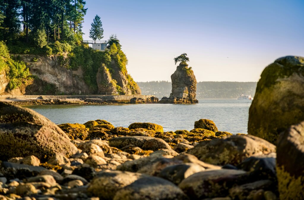
One of the Indigenous landmarks in Stanley Park, sitting between what’s now known as Third Beach and the Lions Gate Bridge, sɬχil̕əx is of cultural importance to xʷməθkʷəy̓əm (Musqueam) people. In xʷməθkʷəy̓əm legend, this site was a transformation site where χe:l̕s (the transformer) “transformed a man to stone for his conduct,” and it stays standing on the coast as a reminder of xʷməθkʷəy̓əm teachings. It is also related to another legend, where “χe:l̕s killed a giant octopus (devilfish) at xʷməθkʷəy̓əm he flung the smallest tentacle and it landed at sɬχil̕əx.” The amount of small octopi living near this coastal landmark is credited to this legend.
“It is important to recognize and use the traditional names of the land we live on, whether they are currently used, or more commonly known by colonial names”
χʷay̓χʷəy̓ (hən̓q̓əmin̓əm̓) / X̱wáy̓x̱way (Sḵwx̱wú7mesh) (Lumberman’s Arch, East Stanley Park)

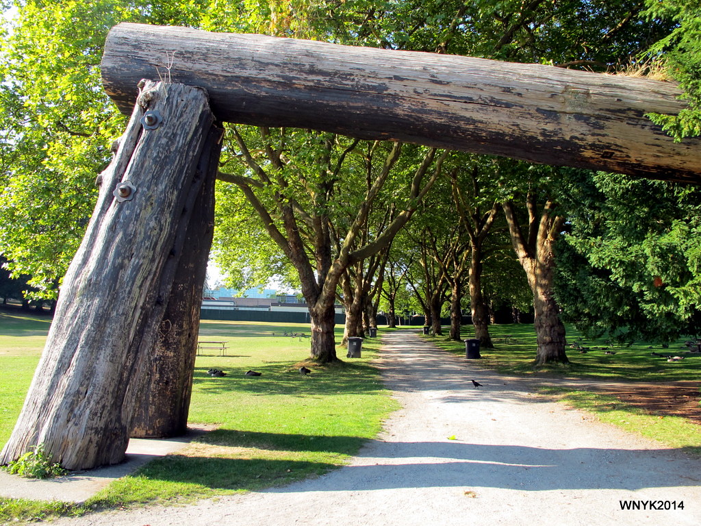
χʷay̓χʷəy̓ was a large village located on the eastern side of Stanley Park, where the Lumberman’s Arch monument, a tribute to BC’s lumber industry, now stands. The site was home to Skwxwú7mesh (Squamish), xʷməθkʷəy̓əm (Musqueam), səlilwətaɬ (Tsleil-Waututh) peoples, with many residents living in multiple longhouses on the peninsula. It was also where xʷməθkʷəy̓əm ancestors “received the sχʷay̓χʷəy̓ mask and teachings; a culturally sensitive hereditary cleansing right.” After British settlers declared Stanley Park lands a military base, the Indigenous inhabitants of χʷay̓χʷəy̓ were systematically pushed off their traditional lands, a process that accelerated when the Stanley Park site was officially declared in 1888. A medical health officer was recorded in the city council meetings, recommending that the buildings be destroyed at X̱wáy̓x̱way because of a smallpox outbreak. The rest of the village was forcibly removed by settler road crews building the original perimeter road, which also disrupted burial sites for their ancestors and belongings.
In 1919, the Art, Historical, and Scientific Association, the precursor to the Museum of Vancouver, proposed to build an “Indian village” near the site where χʷay̓χʷəy̓ had stood. In the early 1920s, the organizations now known as the Museum of Vancouver and the Vancouver Board of Parks and Recreation began importing artefacts like totem poles and canoes from Indigenous peoples on the northwest coast. The idea was to create a village based on traditional Haida construction and art, despite the majority of the nation living hundreds of kilometres away from the park, and the removal of xʷməθkʷəy̓əm and Skwxwú7mesh settlements that had been going on for decades. There have been calls to rename the park to the original village name that it had been known as for centuries, though the name change proposal has yet to be acted upon.
spapəy̓əq (Brockton Point, East Stanley Park)

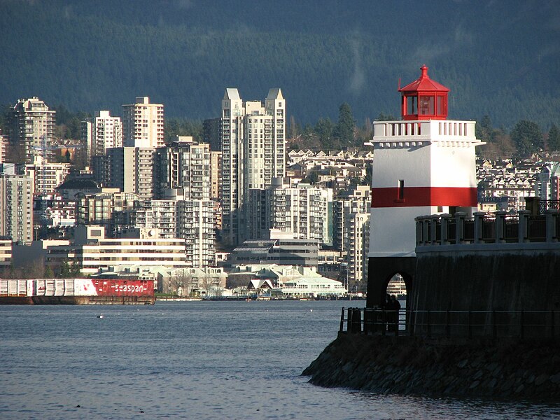
Located on the eastern side of Stanley Park, spapəy̓əq was the site where the last xʷməθkʷəy̓əm (Musqueam) residents inside the park lived before they too were expelled. Currently, the area is known for the Brockton Point Lighthouse, the Nine O’Clock Gun, and the First Nations Totem Poles, some of which originate from χʷay̓χʷəy̓ (Lumberman’s Arch, East Stanley Park) and Chay-thoos (Prospect Point). Along with χʷay̓χʷəy̓, this site was essential for gathering clams, mussels, and crabs. These resources were lost as the Indigenous people were systematically removed from the park’s boundaries. More recently, in May 2023, the xʷməθkʷəy̓əm, Sḵwx̱wú7mesh (Squamish), and səlilwətaɬ (Tsleil-Waututh) Nations, alongside the Vancouver Board of Parks and Recreation permanently raised flags representing the three nations in this area — first time this has happened in a Vancouver park!
Named after the ship that George Vancouver used to “discover” Turtle Island’s northwest coast, the Canadian navy mainly used the island’s buildings in demobilisation efforts after World War I. It has been recognized in local First Nations legend that the colloquial name came to be from the mass casualties from conflicts on the island, both between nations and settlers, and between nations themselves. It has also been recognized as a burial site, where Indigenous peoples placed the deceased in cedar boxes and hung them among the branches of the island’s trees.
Say-mah-mit (Port Moody)

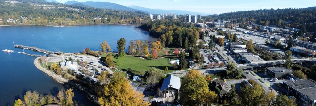
Say-mah-mit was a large səlilwətaɬ (Tsleil-Waututh) village located at Noon’s Creek in the southeastern corner of the səl̓ilw̓ət (Burrard Inlet). The village was an important settlement until Indigenous people were driven out by European colonial settlers. Middens (artifacts associated with past human occupation) contained many remains of eulachon — a smelt fish that navigates both freshwater and saltwater along the west coast — indicating that they were either processed or consumed on this site en masse.
təməsew̓txʷ Aquatic and Community Centre
Recently opened on June 1, the təməsew̓txʷ Aquatic and Community Centre in New Westminster uses xʷməθkʷəy̓əm hən̓q̓əmin̓əm̓ (Musqueam Halkomelem) in its name. təməsew̓txʷ means “sea otter house.” Indigenous knowledge keepers spoke to the naming panel about how sea otters historically ventured far up the Fraser River to New Westminster, a city known for being “where the freshwater of the river meets the saltwater of the sea.” This new aquatic and community space was built to replace two aging buildings: the Canada Games Pool, which was closed in 2021 — earlier than expected due to flooding — and the Centennial Community Centre, which was closed last November.


